Marine Environment
Floating monitoring stations:
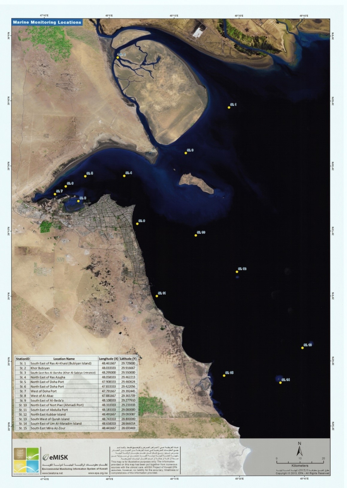
Floating monitoring stations is one of the projects of the development plan of the government work program, as the project includes 15 stations, 10 new and 5 that have been modernized, and these stations monitor, measure and follow up the water quality and specifications for monitoring the marine environment in an instant and continuous way.
The aim to establish a national monitoring network
(Floating monitoring stations to monitor pollutants in the Kuwaiti marine environment):
Firstly: environmental aims:
-Monitoring water quality and pollution indicators, which raises the ability of the Environment Public Authority to deal with any pollution incident.
- Predicting the occurrence of the red tide phenomenon.
- Monitor the high water levels and climate change and participate in internationally prepared reports.
- Supporting the Ministry of Electricity and Water with data to maintain water quality.
Secondly: economic aims:
- Supporting development projects that fall within the marine environment and facilitating decision-making and accreditation.
- Supporting ecotourism and raising the level of water quality, which positively affects marine facilities in the country.
- Reducing the cost of monitoring and control by up to 80% by reducing the operation of boats and laboratories to collect marine samples.
Thirdly: social aims:
- Support public benefit societies, federations of fishers and divers with information that supports their activities.
- Providing data for researchers, specialists and students to support their marine research.
- Providing data for the population of the State of Kuwait in a documented and transparent manner.
Measurements which has been tracked and measured by tracking stations:
- Direction of marine currents
- Velocity of marine currents
- Height and direction of the waves
- Water temperature
- PH
- Dissolved oxygen in water
- Salinity ratio
- Degree of electrical conductivity
- Turbidity
- Chlorville
- Blue-green algae
- Wired alarm system
- Wind speed
- Wind direction
- Air temperature
- Air humidity
- Atmospheric pressure
- Solar radiation
This map clarifies the distribution of the tracking which based on the regional water of Kuwait: